How the third column works
Each table has a short column showing what JS Site Viewer contributes. It means one of three things:
- Base data — the app exports the measured base for that document (site plan base, detail/contour survey sheet, CAD file). A consultant still draws and signs the document.
- Evidence — the app gives you supporting evidence and a mapped extract (controls, hazards, constraints) to hand to whoever prepares the document.
- Consultant — JS Site Viewer produces nothing towards this item. It is prepared by your architect, designer, engineer, registered surveyor, certifier or the council.
1. Required documents
Four documents form the core of a CDC application.
| Document | What it must show | JS Site Viewer |
|---|---|---|
| Architectural plans | To-scale plans showing the architectural elements of the proposed building and works, with detailed floor plans including: north point; room names; all building elevations with external finishes and colours noted; sections; height of buildings and floors; external finishes; finished levels of the development and relative to the surrounding land; the street and neighbouring properties; BASIX and fire safety elements; proposed landscaping; vehicular arrangements (parking areas, drives); waste management (where bins are stored); and water storage, water tanks and on-site detention. | Consultant |
| Site plan | Illustrates the whole development and all features on the site and adjoining land, including structures and buildings, access driveways, roads and landscaping. Includes a north point; site boundaries and dimensions; proposed and existing buildings (including any proposed extensions); setbacks to boundaries; existing vegetation and whether it is proposed to be retained or removed; indicative areas of open space and landscaping; parking and driveways; footpaths and indicative drainage arrangements (if required). It should additionally include contours at 1.0 m intervals — or 0.5 m if the site is less than 1000 m² — services and easement locations, and proposed finished levels relative to adjoining land and roads. | Base data |
| Specifications | A detailed description of the proposed development materials and finishes (including details of new and any second-hand materials) and the method of drainage, sewerage and water supply. Also the height, design, construction and provision for fire safety and fire resistance (if any), and the matters the BASIX certificate for the development requires to be included in the plans and specifications. | Consultant |
| Structural plans | Produced by a structural engineer, providing details of the structural capacity of the proposed work. | Consultant |
2. Additional documents (that may be required)
Whether these apply depends on the development type, the building work and the site.
| Document | What it is | JS Site Viewer |
|---|---|---|
| Accredited building product / system | A building product or system accredited as complying with a requirement of the Building Code of Australia. | Consultant |
| Approved CDC details | The details of an approved complying development certificate, where the application relies on one. | Consultant |
| BASIX Certificate | The BASIX certificate prepared for the project. | Consultant |
| BCA performance requirements compliance statement | Information demonstrating that the development has the capacity to comply with the Building Code of Australia — for example engineer reports for works within 0.9 m of the boundary, or details of an alternative solution meeting the required performance requirements. | Consultant |
| Building upgrade report | Details of the existing building, and any proposed building work to alter, expand or rebuild it. | Consultant |
| Certificate of Title | A document for a land holding recording all details and interests affecting that land — easements, covenants, mortgages, resumptions, caveats and subsequent changes of ownership. | Consultant |
| Compliance certificates / engineering report regarding support of an adjoining wall | Compliance certificates verifying that detailed designs comply with conditions of approval, or that works have been properly executed. The EP&A Regulations require them for certain fire safety aspects, and for certain BCA alternative solutions, before a CDC can be issued. | Consultant |
| Design verification statement | Required for a dual occupancy, manor house or multi dwelling housing (terraces) — see the note above. Prepared by a registered architect or a BDAA-accredited building designer, addressing consistency with the design criteria in the Low Rise Housing Diversity Design Guide for Complying Development. | Evidence |
| Documentation for temporary structure | Enables assessment of the safety of placing temporary structures on a site — fire safety measures, maximum loads, BCA compliance and the number of persons using the structure. | Consultant |
| Bush Fire Protection Measures | Measures under Planning for Bush Fire Protection 2019 used to minimise bush fire risk — asset protection zones, construction provisions, suitable access, water and utility services, emergency management and landscaping. They should relate to any BAL risk assessment certificate issued for the development. | Evidence |
3. Other documents
To complete the assessment, your registered certifier may ask for further documentation — generally about the attributes of your site, such as acid sulfate soil classification, bush fire prone land status or flood affectation. Your certifier will tell you if this is the case.
| Document | What it is | JS Site Viewer |
|---|---|---|
| Owner's consent | Evidence that the owner of the land on which the proposal is to be carried out consents to the application. | Consultant |
| RMS traffic impact statement | Evaluates the impact of the development on the traffic network and justifies the proposed car parking and traffic movements within, into and out of the site. Prepared by a traffic engineer, in accordance with the Roads and Maritime Services Guide to Traffic Generating Development (2002). | Consultant |
| Scaled plan of existing buildings | A plan drawn to scale of existing buildings on the development site and on adjoining sites, also showing existing vegetation and driveway / hardstand areas. Common scales are 1:100, 1:200 and 1:500. | Base data |
| Planning certificate (section 10.7, EP&A Act) | A legal document issued under the Act giving information about the planning rules and whether various restrictions apply to development on that land. Available on application from the local council. | Consultant |
| Section 138 Roads Act 1993 approval | Consent of the appropriate roads authority to erect a structure or carry out work in, on or over a public road; dig up or disturb its surface; remove or interfere with a structure, work or tree on it; pump water into it; or connect a road to a classified road. If the development is on a classified road, approval is required from Transport for NSW; if it is not, the section 138 permit comes from the local council. | Evidence |
| Site contamination statement | A report by a contaminated land specialist, required where the development is on land identified as requiring a preliminary investigation report. | Evidence |
| Soil and water management plan | Outlines the measures to control erosion and sedimentation on the site, detailing the specific methods used at the various stages of construction. | Base data |
| Stormwater management plans | Drawn by a stormwater engineer to enable assessment of the system needed to manage runoff from the site, identifying reuse, water quality and quantity facilities and connections to available services and easements. | Base data |
| Survey plan | Documents the existing site features, topography and built form on the site and adjoining properties: a north point; site area and boundary dimensions; existing buildings, structures and other notable features on the site and adjoining sites; the site's topography (spot levels, contours) and that of adjoining properties; any easements or rights of way; and existing vegetation (location, type, spread). | Base data |
| Tree removal permit | SEPP (Vegetation in Non-Rural Areas) 2017 and/or a council DCP may allow pruning or removal without consent. Check with the relevant local council whether a permit or a development application is required; many publish their criteria online, and the application form comes from the council. | Consultant |
What JS Site Viewer actually produces
To be plain about it: JS Site Viewer is a site-intelligence and evidence tool. It does not draw, certify or sign any of the documents above. What it exports is the measured and mapped base that your consultants draw over, and the constraint evidence that tells them what they are dealing with.
| Output | What it gives you |
|---|---|
| Site plan base | Parcel geometry with boundary dimensions and bearings, contours from NSW elevation data (2 m interval at the finest), and existing built form from official NSW imagery — the base a site plan is drawn over. Note the Guide asks for site plan contours at 1.0 m (0.5 m under 1000 m²), which needs a surveyor's levels, not ours. |
| Detail & contour survey sheet | A levels sheet with contours, spot levels and site fall, for preliminary design and for briefing a registered surveyor. |
| Survey marks (SCIMS) | Nearby NSW survey control marks with their published values, so a survey can be tied to the state control network. |
| CAD output — DXF and LandXML | The parcel, levels and surface exported straight into your architect's, engineer's or surveyor's CAD package. |
| Feasibility compliance block | The planning controls that apply to the parcel — zoning, minimum lot size, height, FSR, setbacks and the relevant CDC design criteria — assembled as one block. |
| Hazard & constraint evidence | Mapped extracts for flood, bush fire prone land, acid sulfate soils, heritage and contamination-notice proximity, plus the classified-road overlay that indicates whether a frontage road is State or Regional. |
4. Reference documents
The NSW planning publications this tool draws on — the two guides behind the checklist above, plus the instruments the site controls it reports are sourced from. We link to the official pages rather than hosting copies, so you always get the current version.
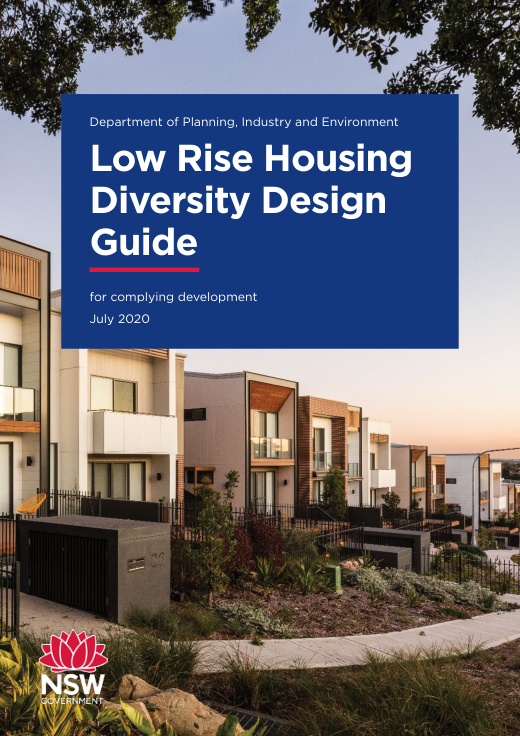
Low Rise Housing Diversity Design Guide for Complying Development
NSW Department of Planning, Industry and Environment · July 2020. The design criteria a dual occupancy, manor house or multi dwelling housing (terraces) design verification statement must address.
Cover image: © State of NSW (Department of Planning, Industry and Environment), CC BY 4.0.
Guide to Complying Development
NSW Department of Planning and Environment · August 2023. The source of the required, additional and other document lists set out on this page.
© State of New South Wales. Reproduced here as a text summary only — the guide's cover and images are not reproduced, as it carries no open licence.
Codes SEPP 2008
The State instrument that sets the complying-development standards — lot size, height, setbacks, floor area and landscaping — for dwelling houses, dual occupancies, manor houses and terraces. The source of most CDC figures the tool reports.
© State of New South Wales. Linked to the official in-force version on the NSW legislation website — no copy is hosted here.
Housing SEPP 2021
Secondary dwellings (Schedule 1) and the Low & Mid-Rise Housing pathway (Chapter 6) — the standards behind the secondary-dwelling and LMR figures the tool reports.
© State of New South Wales. Linked to the official in-force version on the NSW legislation website — no copy is hosted here.
Low Rise Housing Diversity Design Guide (Development Applications)
The development-application companion to the CDC design guide above — the design criteria a merit DA for a dual occupancy, manor house or terraces is assessed against.
© State of NSW (Department of Planning, Industry and Environment). Reproduced under CC BY 4.0.
Tree Canopy Guide for Low and Mid Rise Housing
The tree-canopy, deep-soil and planting requirements the Housing SEPP directs the consent authority to consider for low and mid rise housing — the source of the tool's canopy and deep-soil figures.
Open on the DPHI guidance page ↗
© State of New South Wales (Department of Planning, Housing and Infrastructure). Linked to the official DPHI guidance page.
Wollongong DCP 2009 (Ch B1 — Residential)
The local development controls the tool references for sites in the Wollongong LGA. Council DCPs for Shellharbour and Shoalhaven are also referenced for those LGAs.
© Wollongong City Council. Linked to the council's official PDF — no copy is hosted here, as it carries no open licence.