Context & catchments at a glance
Ten minutes, measured properly.
A circle drawn on a map is not a catchment. The Catchment tool computes a real isochrone from the selected lot — the area you can actually reach in a given time by car, on foot or on a bike, following the road and path network, with the shape that produces.
On a site bounded by a river, a rail line or a motorway with no crossing, the difference between the circle and the isochrone is the whole argument. It is also the number that goes into the marketing copy for whatever gets built, so it is worth having the honest version.
Schools, demographics and the road out front.
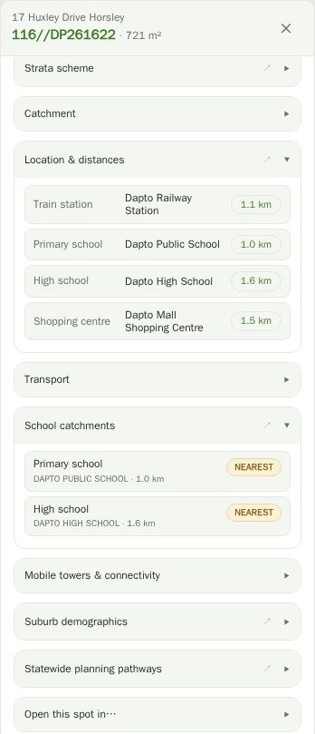
School catchments resolves which public schools the address is actually zoned for, primary and secondary — which for family housing is frequently the single strongest driver of value, and is otherwise a separate portal.
Suburb demographics pulls the ABS census picture for the surrounding area: who lives there, in what, and how that has moved. Location & distances gives the straightforward proximity list.
Road classification is the quiet one that catches people. If the frontage road is a State or Regional road under TfNSW, development can trigger a referral and separate access and setback requirements under the Transport and Infrastructure SEPP. The overlay colours State roads red, Regional blue and local grey, so you can see it before it becomes a condition.
And the services the site will need.
Utilities & infrastructure shows the mapped infrastructure around the site including power lines, and Services & easements covers what runs through the parcel itself. Mobile towers & connectivity and NBN rollout status cover the communications side, which matters more for a residential product than it used to.
For situational context there is live public transport positioning from Transport for NSW, and — because it is genuinely useful over an airport-adjacent site and mildly entertaining everywhere else — live aircraft positions.
Questions
Does the drive catchment account for traffic?
No. It uses typical network speeds rather than live or time-of-day traffic conditions, so treat it as a good-conditions catchment. Peak hour will be smaller.
Are school catchments authoritative?
They are the published catchment boundaries, and they do change. For anything you are going to put in writing, confirm against the NSW Department of Education school finder for the specific address.
What does the classified road overlay tell me?
Whether the road at the site’s frontage is a State or Regional road under TfNSW. That matters because it can trigger a referral to TfNSW and bring separate access, setback and traffic requirements into play under the Transport and Infrastructure SEPP. It is a flag to check the SEPP, not a determination.
Can I rely on the infrastructure layers for excavation?
Absolutely not. They are derived from OpenStreetMap and public datasets and are incomplete by nature. Dial Before You Dig is a legal requirement and this does not substitute for it. Sydney Water mains in particular are not available to us as data — the app deep-links to their portal instead.
Do catchments need Pro?
Yes — each catchment is a routing computation against an external service, so it sits in Pro. Schools, demographics, proximity, transport and road classification are available on the site report.