Hazards & overlays at a glance
Every constraint, on the lot, in one pass.
Constraint due diligence is normally a tab-per-portal exercise: the flood map here, the RFS map there, heritage somewhere else again, and the EPA register on a site that looks like it was built in 2004. Miss one and you find out after you’ve paid for it.
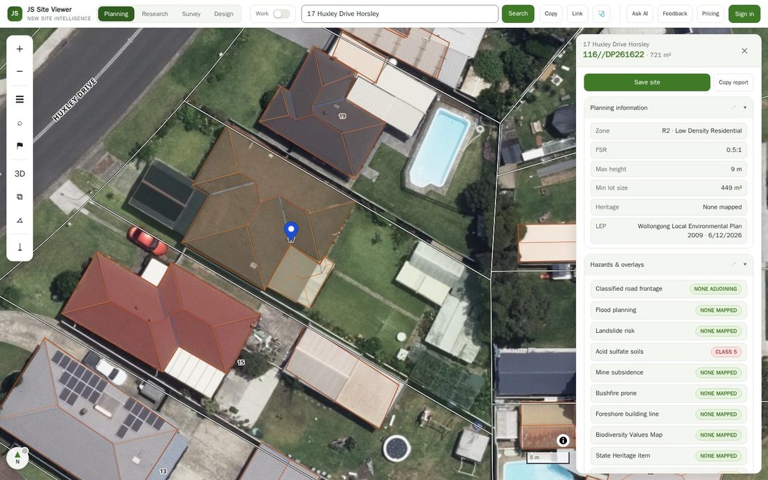
Open a lot in JS Site Viewer and the Hazards & overlays section runs all of them at once and tells you which ones bite — on-parcel for the mapped polygons, and within 250 m for EPA-notified contamination. Anything that applies is called out; anything that doesn’t is explicitly cleared, so a blank result means "checked and clear", not "didn’t look".
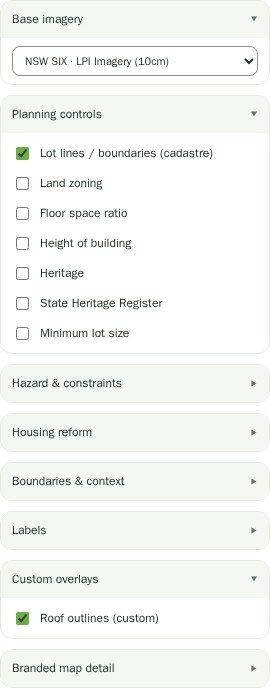
The same constraints can be switched on as map overlays, so you can see how far a flood or bushfire polygon extends past the lot and whether you are three metres inside it or three hundred.
Hazards are free. Deliberately.
Most of the app’s deeper analysis sits behind Pro. Hazards do not, and that is a decision rather than an oversight: most of them are served from our own cached vector layers rather than a metered government API, so they cost us almost nothing per lookup — and they’re the check that most often changes someone’s mind about a site.
You can open any parcel in New South Wales, without an account, and see whether it’s in a flood planning area or on bushfire prone land. If that’s all you ever use the tool for, that’s fine.
The layers behind the flags.
Flood planning area and landslide risk come from the NSW Department of Planning, Housing & Infrastructure hazard layers, cached and re-served by us. Bushfire prone land is the NSW Rural Fire Service Bush Fire Prone Land map — the same map that decides whether your DA needs a bushfire assessment. That one is queried live against the state service on each lot rather than cached, because the statewide layer is too large to hold, so it is the layer most likely to be slow or briefly unavailable if the government service is down.
Acid sulfate soils, foreshore building line, coastal environment area, drinking water catchment and the Biodiversity Values Map come from the DPHI protection layers. Biodiversity Values is the one that triggers the Biodiversity Offsets Scheme, and it is routinely the most expensive surprise on this list.
Heritage covers both the State Heritage Register (Heritage NSW) and LEP-listed heritage items. Contaminated land is the EPA’s Record of Notices. Mine subsidence is the Subsidence Advisory NSW district map, and ANEF is the airport noise exposure forecast contour.
Questions
Does a clear result mean the site has no constraints?
No. It means none of the twelve mapped layers we check cover the parcel. Unmapped or council-specific constraints, contamination that was never notified to the EPA, and anything recorded only on the title or in a council record will not show up here. The section 10.7 certificate is the authoritative answer.
Is this the same flood layer the council uses?
It is the flood planning area published in the NSW planning EPI layers, which is what most councils map. Councils also hold their own detailed flood studies with flood planning levels, probable maximum flood extents and hydraulic categories that are not in the state layer. If flood matters to your project, get the council’s flood advice.
Why is bushfire prone land shown in categories?
The RFS map distinguishes vegetation categories and buffer zones, because the category drives which construction standard applies under AS 3959 and whether a bushfire assessment is required. We show what the RFS map says for the parcel.
Do I need to pay to see hazards?
No. Hazards and overlays are free on every lot in NSW, with no account required. Levels, cut and fill, catchments, development applications and the feasibility financials are the Pro sections.
What does the Biodiversity Values Map flag actually mean?
That the land is mapped as having high biodiversity value, which means clearing above the relevant threshold triggers entry into the Biodiversity Offsets Scheme — and an offsets obligation that can be material. It is a flag to get an ecologist’s advice early, not a determination.